_We may earn revenue from the products available on this page and participate in affiliate programs. Learn more ›
_
Perhaps you’re occasionally checking your smartphone’s built-in mapping software while driving to a remote trout stream, or using Google Earth on a home computer to scout out new hunting
and fishing destinations. Maybe you regularly rely on a dedicated GPS device like a handheld navigator
or dog collar to keep track of whereabouts afield. Regardless of how you enjoy the outdoors, like most hunters and anglers these days, you’ve probably tapped into the Global Positioning System in one way or another to improve your outdoor experience. But how does GPS work?
Since the U.S. satellite-based system initially limited to military applications was fully opened to civilian use in 2000, sportsmen have been among the most ardent adopters of GPS. But how much do we really know about the technology behind this space-age wonder?
How GPS Works: Seeing the Big Picture

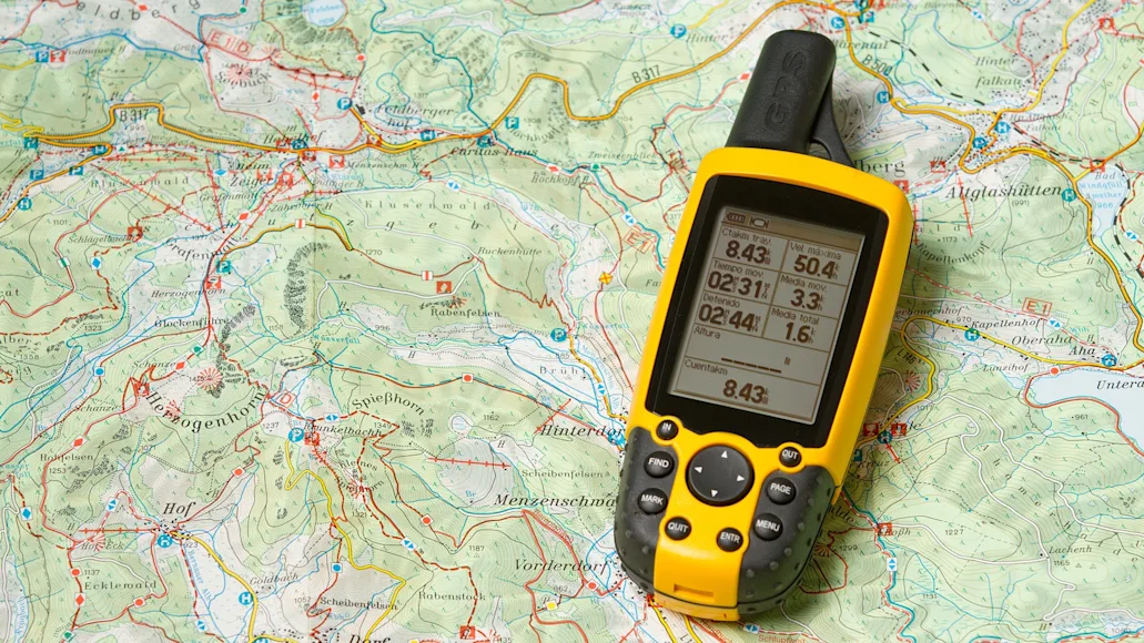
ach satellite is constantly sending a unique radio signal relaying its location, speed, and time of broadcast to ground stations and to GPS receivers built into watches, mobile phones, and dedicated GPS devices. Adobe Stock / EVERST
If you’ve ever found yourself turned around in the backcountry, or just wanted to gain some perspective on a piece of ground you’re hunting for the first time, you’ve likely heeded a basic principle of wayfinding: Head for high ground. By hiking to the top of a rise or simply climbing a tree, you can improve your vantage point and gain a better perspective on your surroundings. The Global Positioning System uses the ultimate high ground—space—by deploying a system of multiple satellites positioned around the globe. Each satellite is constantly sending a unique radio signal relaying its location, speed, and time of broadcast to ground stations and to GPS receivers built into watches, mobile phones, and dedicated GPS devices.
How GPS Works: Narrowing the Focus
By combining data from four satellites at once, a GPS receiver can pinpoint its position on the globe through a process called trilateration. Here’s how it works.
A signal broadcast from a single satellite is picked up by a GPS receiver, which then calculates the distance from the receiver to the satellite. This process creates a circle (technically a sphere, since it represents our three-dimensional world) that identifies a circular area on the earth’s surface where the GPS receiver could be located.
A second satellite signal to the GPS receiver creates a second circle, which overlaps the first. This narrows down the potential location of the GPS receiver to one of two points where these circles intersect.
A third satellite signal creates a third circle. The point where all three circles intersect can now identify a precise terrestrial location, although data from a fourth satellite is usually added to validate the information provided by the other three and to provide a three-dimensional reading that allows for the calculation of the GPS device’s altitude. Most consumer GPS devices can receive signals from up to six satellites at one time, but only four are needed for an accurate reading.
How GPS Works: Accuracy
When the forerunner of today’s Global Positioning System was launched by the U.S. Navy in 1957 to track submarines during the Cold War, GPS was largely a military technology inaccessible to consumers. That began to change in 1983, when the U.S. announced it would make GPS available for civilian use as a way of improving aviation safety, which led to the introduction in 1988 of the first hand-held GPS device (Magellan’s NAV 1000
, a 1.5-pound, $3,000 device with just a couple of hours of battery life). But in 1990, the U.S. Department of Defense began decreasing the accuracy of GPS readings for nonmilitary users. Selective Availability, as this degradation of GPS accuracy was known, was discontinued in 2000, giving consumer users the same precision long enjoyed by the military. GPS devices now are accurate to within 7 meters (about 22 feet) anywhere on the planet around 95 percent of the time.
What about the other five percent of the time? There are several factors that can affect GPS accuracy.
Physical obstructions: Large masses such as mountains, trees, and buildings can alter the arrival time (the length of time it takes a signal to travel from satellite to GPS device) resulting in a skewed location reading. This is most pronounced in cities, where a signal often bounces off buildings before being read by the device.
Atmospheric anomalies: Solar storms, disruptions in the ionosphere, or even heavy storm clouds can hinder the delivery of a clear signal from satellites to GPS devices.
Intentional interference: Jamming or spoofing devices such as those created by the military to conceal vehicle and troop movements have gained wider use by car thieves, speeding drivers and toll scofflaws despite being outlawed in many countries, including the U.S.
FAQs
The constellation of 31 GPS satellites developed and operated by the U.S. is just one of four global positioning systems that are currently operating in medium earth orbit. The other three are Galileo, developed and operated by the European Union; GLONASS, developed and operated by Russia; and BeiDou, developed and operated by China. Japan and India also have plans to expand their regional satellite tracking systems to global coverage.
GPS satellites circle the earth twice a day at an altitude of 13,000 miles while traveling at a speed of 8,700 miles per hour. Between them, the four global satellite tracking systems have around 115 satellites in orbit.
In addition to pinpointing location, GPS data is useful for tracking, navigation, setting waypoints and as the basis for a wide range of research projects on animal behavior, from the usage of core areas by whitetail deer
to the transglobal migration of large ocean predators such as great white sharks
and bluefin tuna.