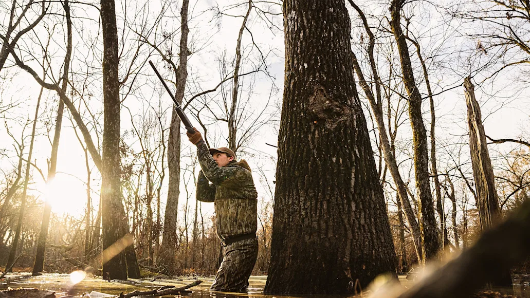
I’ve been an onX Hunt user for well over a decade, and like many other hunters, I underutilize the app, especially for waterfowl pursuits. Most people download onX to view property borders and to identify chunks of public land where they can legally chase critters. That specific onX feature alone revolutionized the hunting world by providing an accurate database for public hunting access across the entire country. But there is so much more the app can do.
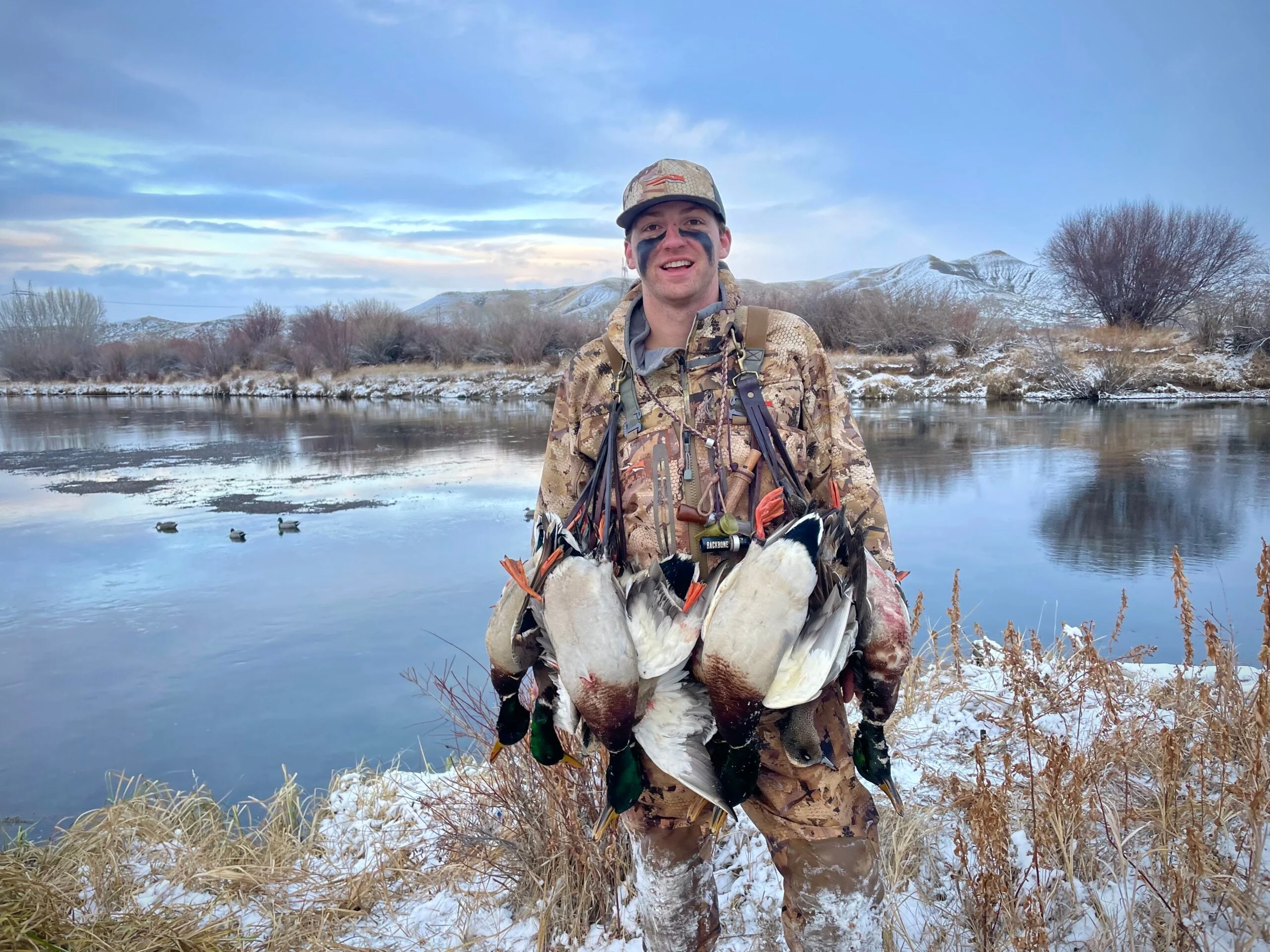
Last fall, I decided it was finally time to start using my onX subscription to its full potential—and help me kill more ducks. So, I spent the summer discussing the new features with the folks at onX before putting them to use during the season. Then, in late December, I shared a timber hole with a member from the onX waterfowl marketing team, Lake Pickle, who opened my eyes even wider to the capabilities of the app.
Now, I have an onX playbook—five different strategies, some old, some new, to help identify wetlands, scout, and hunt waterfowl across the country. Use these tips below to get more out of your onX Hunt subscription that you already pay for.
1. Use the Recent Imagery Tool to Identify Water Levels
OnX added an array of new features to the app in 2023, and of all of them, the recent imagery tool is by far the most useful for waterfowl hunters. This application allows users to view any recent changes in the landscape. Specifically, onX updates its maps with medium-resolution images every two weeks so hunters can monitor freeze lines, snowpack, wildfires, or any other landscape alteration.
For waterfowlers, this tool allows us to monitor the water levels of potential hunting locations. For instance, most of my late-season hunting takes place on the South Platte River in eastern Colorado, which is a two-hour drive from my home in Denver. With the recent imagery tool, I can see what side sloughs and ponds off the main river are holding water, and I can get a rough idea of the river level without making the long trek. It is also helpful for monitoring field cuts.
How to Use
To use the recent imagery tool, first make sure your onX app is updated. Then, in the app, click the “Sat 2D” square in the bottom right corner. Once the tab opens, scroll to the bottom and toggle “recent imagery” to on. Now, you’ll be viewing the most recent photo of the area. Hunters can view images all the way back to March of 2023 by changing the recent imagery date in the bottom left-hand corner, right above the hunt layers tab.

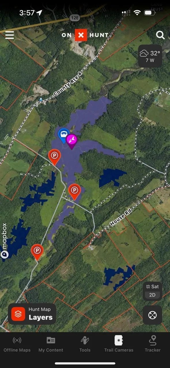
2. Employ the Wetlands Layer When Scouting
A couple of years ago, onX introduced the wetlands layer, which highlights marshes and other bodies of water in two different shades of blue on the map. The darker blue color represents “woody wetlands,” better known as flooded timber in river bottoms and lakes. While the lighter blue shade represents “herbaceous wetlands” or traditional marshes, flooded grasses, and cattails.
This is an excellent scouting tool, especially when exploring new areas. It allows hunters to quickly identify historically wet locations that could potentially hold ducks. Previously, this layer was only half as helpful because users weren’t able to see current water levels. Now, paired with the recent imagery tool, these two features can be a deadly scouting duo.
How to Use
First, identify a large general area you plan to hunt. Then, under hunt layers, toggle your wetlands layer to “on” and make sure both your woody wetlands and herbaceous wetlands sublayers are also on. This will immediately highlight historically wet areas on your screen. Once you find a piece of wetland that you think might be good, toggle on your recent imagery tab to see an updated water level. Now, you’ll have a general understanding of the habitat, current water level, and public or private access.
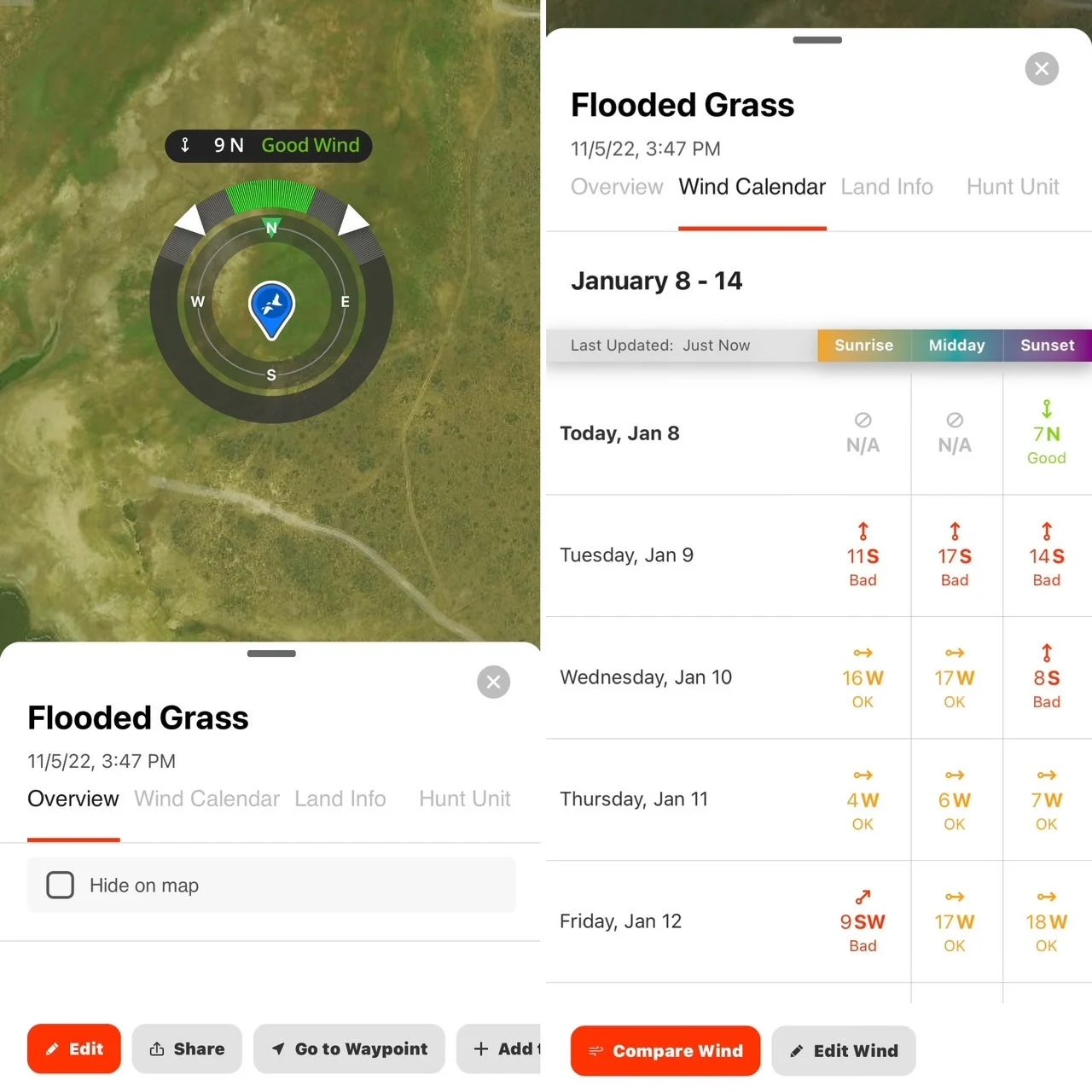
3. Customize Your Waypoints for Wind Direction
Mostly used by whitetail hunters, onX’s wind-direction function can be a big help to waterfowlers, too. For every duck blind/spot you have marked, go in and add the optimal wind you would hunt it on. The waypoint will always appear with the wind strength as a number and the wind direction as letters. Based on what you set the optimal wind for, the letters and numbers will be highlighted in green, yellow, or red to tell you if the wind is good to hunt that day.
Furthermore, hunters can use the wind calendar to view future winds for a particular blind. This will give hunters the wind forecast at sunrise, midday, and sunset for the next seven days. Again, optimal winds will be highlighted in green, and poor winds will be highlighted in red.
How to Use
In your onX app, select a waypoint you would like to add an optimal wind for. Once the waypoint opens, scroll down to where it says “waypoint tools.” Then select “wind direction” and click on “set optimal wind.” Set the best winds for that location. The current wind will now appear on that waypoint.
To view future wind forecasts, select a waypoint and slide over to “wind calendar.” The app will now display the wind for the next seven days, along with when it is best to hunt.
4. Scout and Mark Everything You Find
If you see something worth noting, then drop a pin. That may seem obvious, but the simple stuff goes a long way. Scouting is absolutely critical to success in the duck blind, and onX is one of the best scouting tools in existence. I can’t tell you how many times I set a waypoint that seems miniscule at the time, but later benefits me. Of course, this means you actually need to spend time in the truck looking for birds, water, access, and so on. Scout, scout, scout, and mark everything you see. Then scout some more. Oh, and make sure to use different color pins to stay more organized. Blinds are blue, birds are red, and access is green. You get the point.
Here is a list of everything I like to mark for duck scouting missions:
Ducks and geese
Boat ramps
Potential kayak put-ins
Road access
Habitat—wet, dry, muddy, etc.
Potential blind setups
Where cripples fell
Potential areas to hunt/scout
Houses where I should ask permission for private land access
5. Use the Private Land Layer to Identify Property Owners/Ask for Permission
The only thing worse than finding a private field loaded with ducks and geese is not even knowing who to ask about hunting it. One of the best features of onX is the ability to view any landowner’s name and address. This opens the door to gaining permission on any parcel. Once you identify a field, pond, or piece of land you’d like to hunt, you can approach the correct address with the owner’s name to ask for permission.
Basic tips on successfully gaining hunting permission still apply, like dressing in street clothes, approaching the house with one or two people maximum, being extremely polite, and standing back from the door when someone answers. Another strategy is to try finding the person on social media or online to obtain a profile or phone number you can message or call.
