Hunting Gear
Camping

Buyer's Guide
- How to Fish a Chatterbait
- The Best Inshore Spinning Rods of 2024
- Spin Fishing for Trout: A Complete Guide with Expert Tips
- Bass Pro Is Having a Huge Sale on Fishing Gear Right Now—Up to 54% Off
- Best Chatterbait
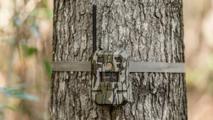
- Tactacam Reveal X Gen 2 Review
- Waterfowl Workbench: How to Re-Flock Goose Decoys
- Plano Tackle Boxes Are Up to 50% Off Right Now
- How to Hunt the Best Day of the Strut No. 3: April 17
- Best Trout Spinning Reels
- First Look: Magellan Outdoors Pro Pedal Drive Fishing Kayak
- This Is the Perfect EDC Knife—And It’s 50% Off Right Now
- The 25 Best Mother’s Day Gifts for Moms Who Hunt
- The Best Trail Camera Deals Right Now—Up to 62% Off
- Hardy Marksman Z Saltwater Fly Rod, Tested and Reviewed
- Polaris Ranger XP Kinetic UTV, Tested and Reviewed
- The Best Turkey Hunting Boots of 2024, According to Experts
- Ned Rig Fishing for Bass: A Complete Guide
- This Fishing Tackle Backpack Can Hold All Your Gear—And It’s $25 Off Right Now
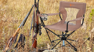
- This Ground Blind Has Become My Favorite for Deer Hunting—Here’s Why
- Shotgun Review: Mossberg Silver Reserve Eventide Turkey, Expert Tested
- The Best Turkey Broadheads of 2024, According to Experts
- RMR vs SRO: Which Trijicon Red-Dot Sight Is Right for You?
- This Sig Sauer Scope Is Incredibly Clear—And It’s 50% Off Right Now
- Best Portable Fish Finders
- Shave and a Hair Bug: How to Tie and Fish Deer-Hair Flies
- The 33 Best Deals on Turkey Hunting Gear Right Now
- How to Catch Crappie: A Complete Guide
- We Tested and Ranked the 6 Best Handgun Safes of 2024
- Best Turkey Calls
- How to Shoot Trap, Skeet, and Sporting Clays
- Turkey Hunting in the Wind: How to Get Your Gobbler in a Gale
- Behind the Brand: An Interview with DSG Founder Wendy Gavinski
- How to Use Shooting Sticks from the Standing Position
- Best Places to Buy Ammo Online
- This Fishing Line Spooler Will Make Your Life Easier—And It’s Just $29 Right Now
- Best Bass Fishing Rods
- This Universal Gun Cleaning Kit Has Everything You Need—And It’s 50% Off Right Now
- Best Turkey Loads of 2024, Tested and Reviewed
- The Great 308 Family of Hunting Cartridges
- 2024 Bass Lure Bracket: The Championship
- This Bushnell Sight Is Incredibly Clear—And It’s 50% Off Right Now
- The Best Bug Out Bags of 2024, Tested and Reviewed
- 5 Patterns Every Fly Fisher Should Know
- How to Use a Turkey Mouth Call Like a Pro
- The 15 Best Bass Fishing Gifts of 2024
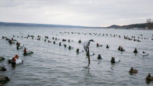
- Best Goose Decoys: A Guide to Full Bodies, Silhouettes, Floaters, Socks, and Shells
- This Portable Knife Sharpener Is Perfect for in the Field—And It’s Only $35 Right Now
- Best Walleye Lures
- 7mm 08 vs 308 Winchester: Which Is Better?
Latest
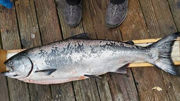
California Cancels Salmon Season for Second Consecutive Year
The Pacific Fishery Management Council acted unanimously to prohibit ocean salmon fishing for a second season
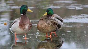
Drones and Infrared Cameras Help Monitor Atlantic Flyway Duck Broods
Ducks Unlimited has partnered with several state and federal agencies as well as two universities to use GPS telemetry units and drones to better understand declining waterfowl populations
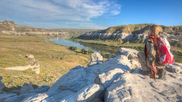
New Rule Will Change the Way the Federal Government Manages 245 Million Acres of Public Land
The rule change will put public land conservation projects on a level playing field with other uses like mining, grazing, and energy development
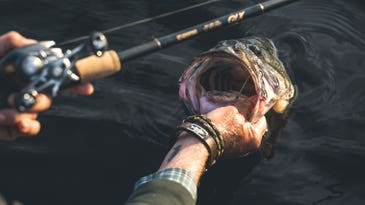
How to Fish the Best Day of the Spawn No. 4: April 23
Three out of our five experts picked tomorrow as the best day of the 2024 bass spawn. So get out there and follow their advice to cash in
Why Earth Day Should Matter to Hunters and Anglers
No group has benefited more from the legislation that's been passed since the first Earth Day than sportsmen and -women. Why then do so few of us celebrate the holiday?
Don’t Miss the First Ever Field & Stream Music Fest!
The 3-day event in South Carolina later this fall is sure to be the wildest party of the year

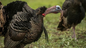
The Gobble Report: Here’s When Turkeys Will Talk, Strut, and Come to Your Calls
We studied a data set of nearly 300 harvested turkeys from 17 states and analyzed weather, time of season, time of day, and location to learn when toms act right
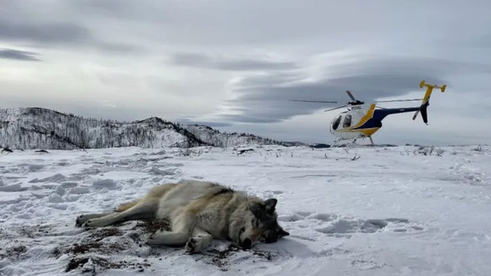
Feds to Deny Permit for Proposed Mining Road Through Alaska’s Famed Brooks Range
Hunters and anglers fought to oppose a 211-mile industrial corridor that would have disrupted fish habitat and bisected ancient caribou migration routes in Alaska
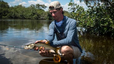
Snook Fishing 101: A Beginner’s Guide
So you want to catch a snook? Learn how to target one of Florida's most popular and aggressive gamefish by boat and on foot
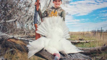
Young Hunter Tags Rare All-White Turkey in North Dakota
Archer Eagleson shot the jake over decoys while hunting from a ground blind with his dad
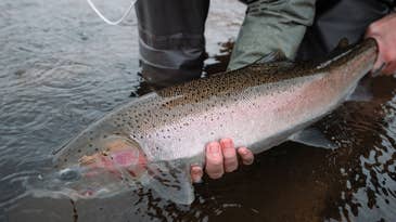
Oregon River Sees Best Steelhead Run in 20 Years
Nearly 8,000 winter steelhead have climbed a fish ladder on the Willamette River this year
Study Suggests Possible Link Between CWD and Fatal Human Disease—But with Many Open Questions
Should you be alarmed? Probably not if you read the fine print. The study merely concludes that a link can't be ruled out and that more study is needed
How to Hunt Turkeys in the Rain—Three Keys to Success
It's going to rain during turkey season, probably a lot. You can stay home or follow these tips to go get your gobbler anyway
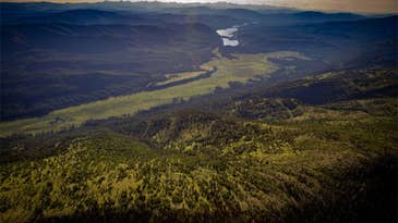
Proposed Easement Would Preserve Hunting Access on 33,000 Acres in Western Montana
The Montana Great Outdoors Conservation Easement would conserve a large swath of key habitat—and hunting grounds—for elk, deer, and moose